

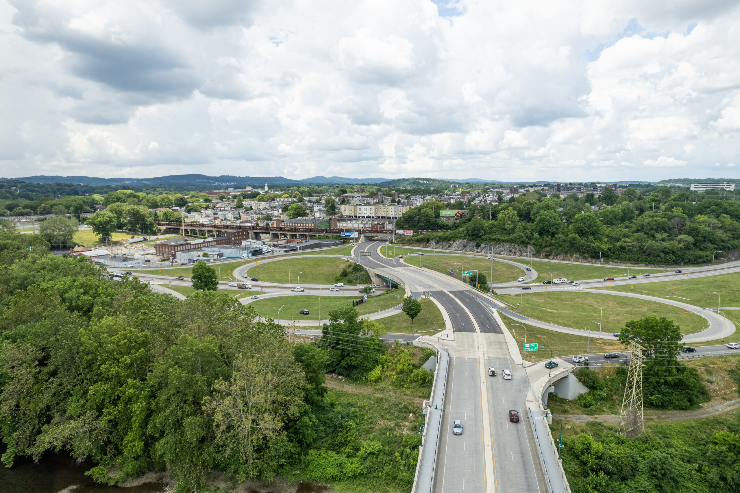
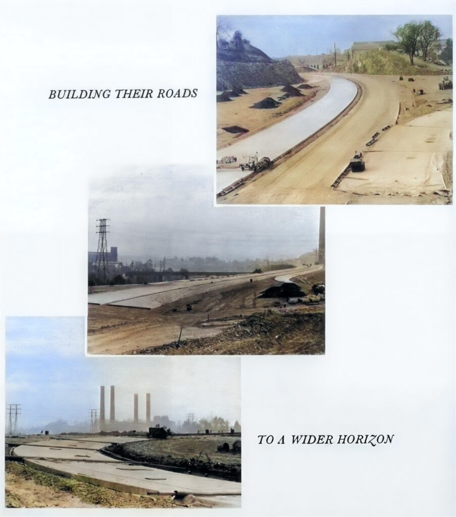
We all have driven on route 422…the stretch of highway that runs past Reading and along the Schuylkill River down to Pottstown. This stretch of road did not always exist. In fact it wasn’t until the 1960s that US 422 in the Reading area was rerouted from surface streets through downtown Reading onto bypasses built south of the city. The former routing of US 422 through the city became US 422 Business. Prior to this, there was a section of buildings and businesses along the first block of Penn Ave right before the Penn Street Bridge. They were ultimately taken and torn down, to accommodate the building of the clover leaf ramp system for the new 422. Below are a few images of the 100 Block of Penn Ave before the highway was built.
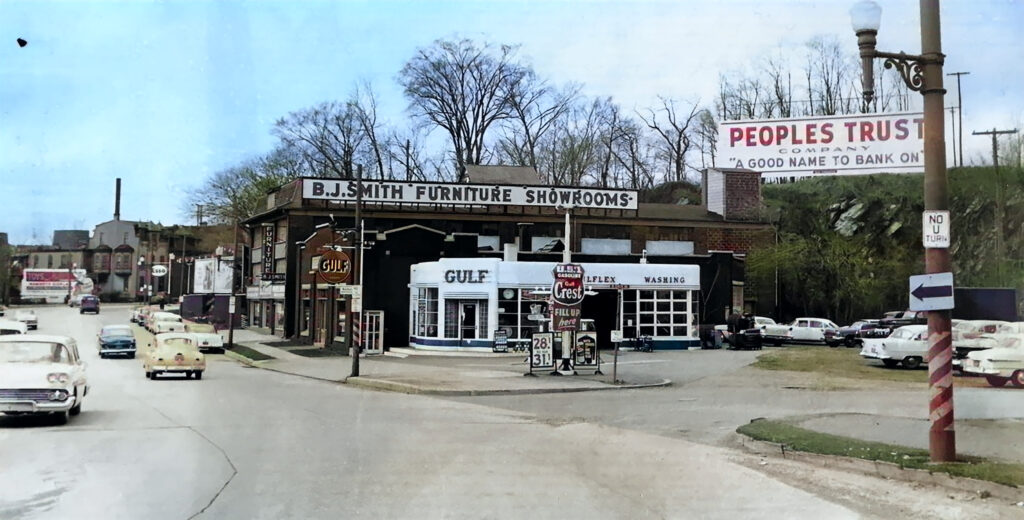
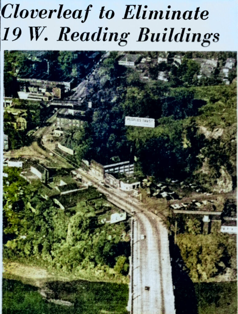
On October 3rd 1956 an article ran in the Reading Eagle announcing that 19 buildings would definitely have to be removed to make way for the bypass exchange. Those that occupied the structures were listed as: Laurel Hosiery Co, Inc., 1 Penn Ave.; service station at 15 Penn Ave.; Memorial Arts Studio, monument works, 17 Penn Ave.; Keiser Manufacturing Co., 20 Penn Ave.; B.J. Smith Furniture and Showroom, 21 Penn Ave; Hen Johnston, Inc, 40 Penn Ave.; Pear & Co. scrap yard at the rear of 40 Penn Ave.; service station at 46 Penn Ave.; Atlantic Refining Co. regional office, 64 Penn Ave.; service station at 107 Penn Ave.; and Royalton Knitting Co., 123 Penn Ave. More buildings joined this list later as Brown’s Diner isn’t amongst the casualties. The actual construction of this cloverleaf exchange would not commence for another seven years.

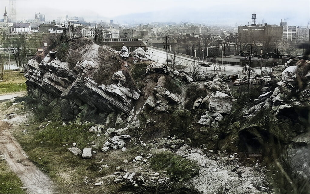
Leinbach’s Hill & Cave
Recently a follower sent in a fantastic photo of some of the rock formations that made up the east side of Leinbach’s Hill before it was removed to build the bypass. There was a cave entrance (visible in the lower right of the photo below) on the back side of rock formation. This site was quarried in the late 1800s into the 1900s, so that is likely the origins of the cave. If you remember or know anything about the cave, please drop a comment.
That Gulf gas station was where my grandfather worked.. not sure if he ran it or just worked there. And it would have been in 50’s and earlier. Thanks for picture!
I had forgotten what the area looked like, thanks for the post!
I was born and raised in West Reading and we used to walk past this area all the time. I remember 3 gas stations, a company that made grass shears, a heating oil company, furniture store, post office, V.F.W club, Browns Diner. I’m sure there were others that I missed. West Reading lost a lot of taxable properties for that highway.
Awesome shots
The prior was before my time so it was neat to see what the area looked like. Keep these awesome pieces of history coming!
That is Leinbach’s Hill behind the Gulf Station (first photo). Brown’s Diner/Restaurant was just out of the photo to the left.