
This is another installment in the “Before Blue Marsh” series, where I explore the remains of various properties that were razed in the 1970s to make way for the Blue Marsh Lake Project. See more here.
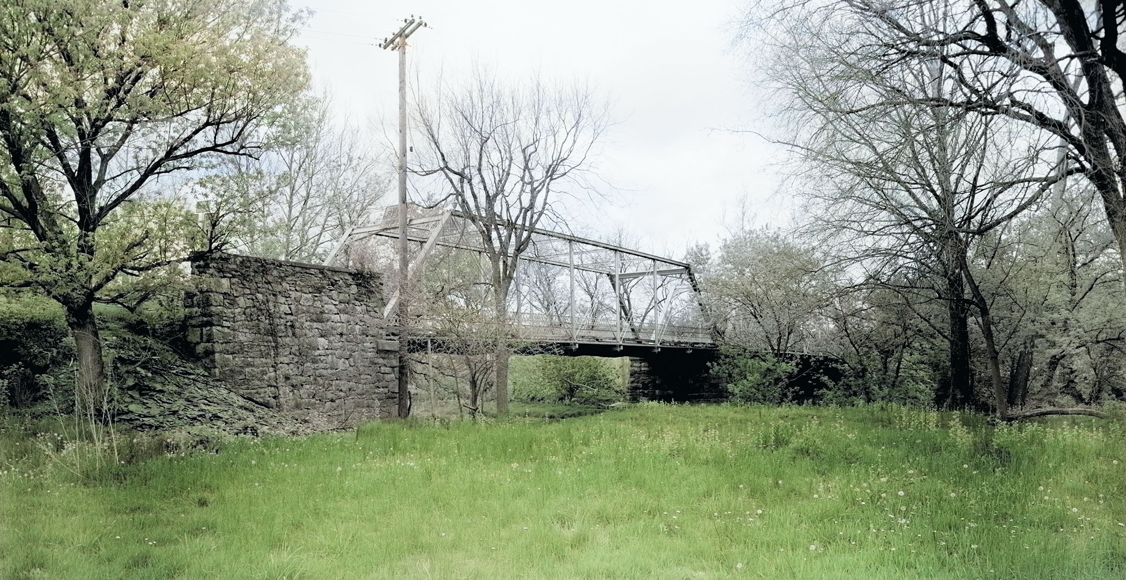
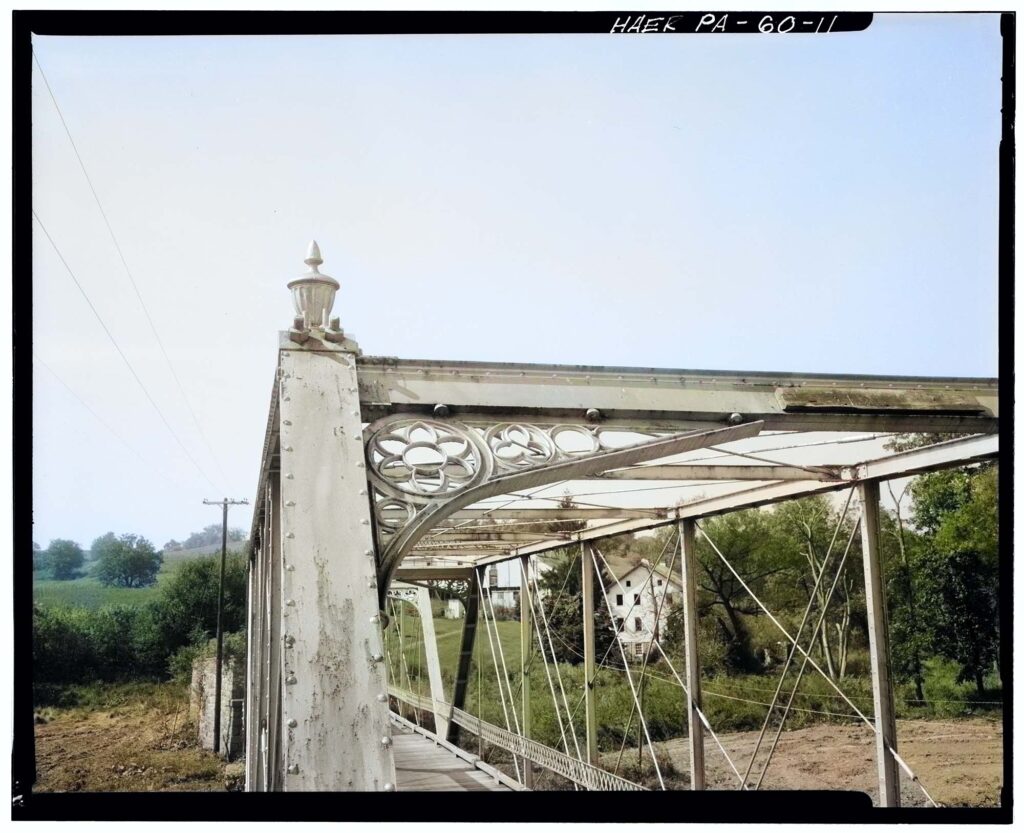
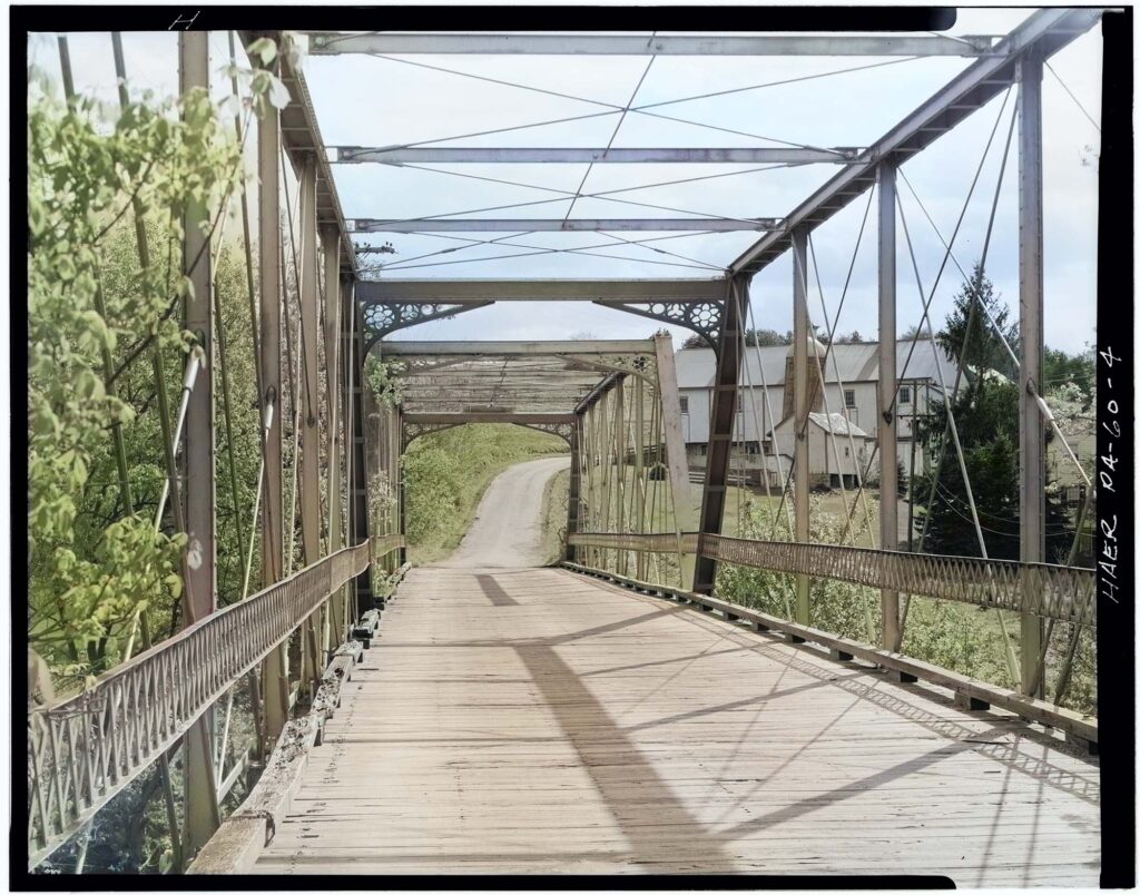
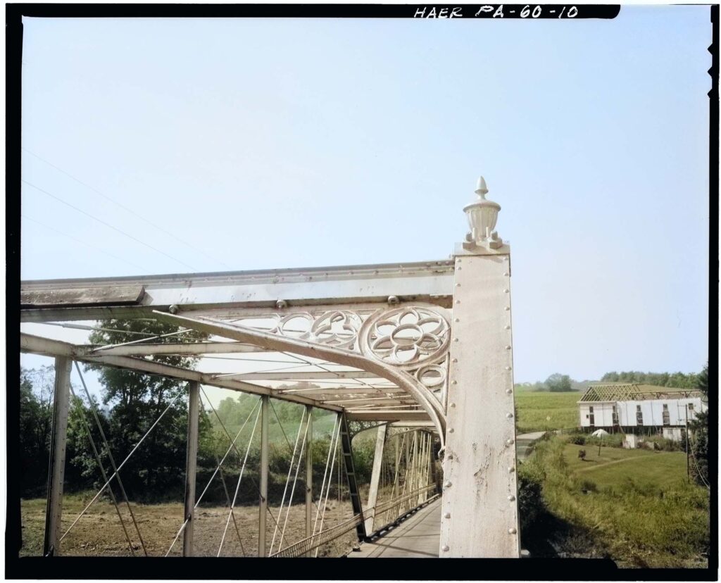
Speicher’s Bridge was constructed in 1878, spanning the Tulpehocken Creek along Church Road connecting the townships of Penn and North Heidelberg. The bridge was built as a means of connecting North Heidelberg to what is now Bernville Road, which provided easier access to Reading. The bridge was built at a time when the Union Canal, once-thriving way of moving goods about the region along the Tulpehocken, was beginning to wane. Area residents petitioned Berks County Commissioners to build the bridge at the site of “Speicher’s Ford”. As mentioned in previous posts, the Speicher family were early settlers in this region, and owned many of the farms around the bridge, lending to its name.
In February 1878 the contract for the bridge was awarded to Morse Bridge Company of Youngstown, Ohio for $2,916.50. The contract for the stone abutments went to Marlsberger and Company for $2,381.10. It was completed in October 1878.
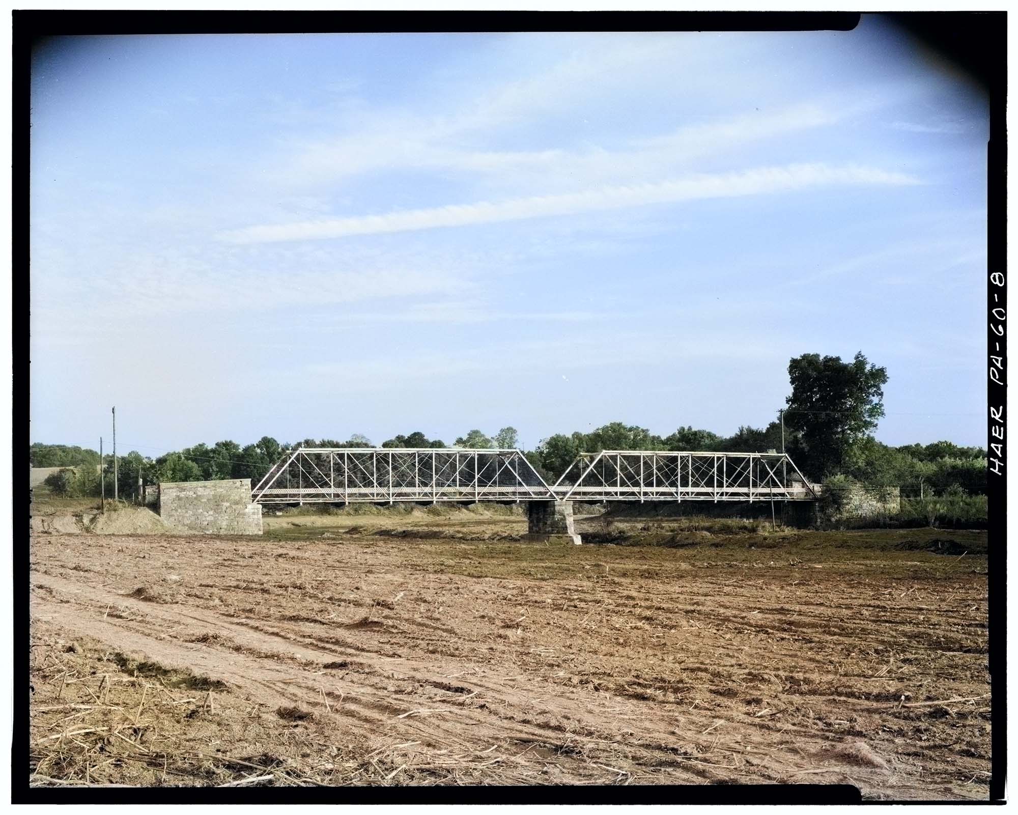
The bridge, which was made of wrought iron, was comprised of two 100×18-foot-spans. The landing of the bridge was made of wooden planks. If you would like to read more about the engineering of the bridge, check out the Library of Congress report viewable here. Obviously this bridge was dismantled as it stood in the middle of what is now Blue Marsh Lake, but it is interesting to consider that this bridge would have been growing inadequate for modern traffic; and what would have been its fate if the lake project didn’t already seal it?
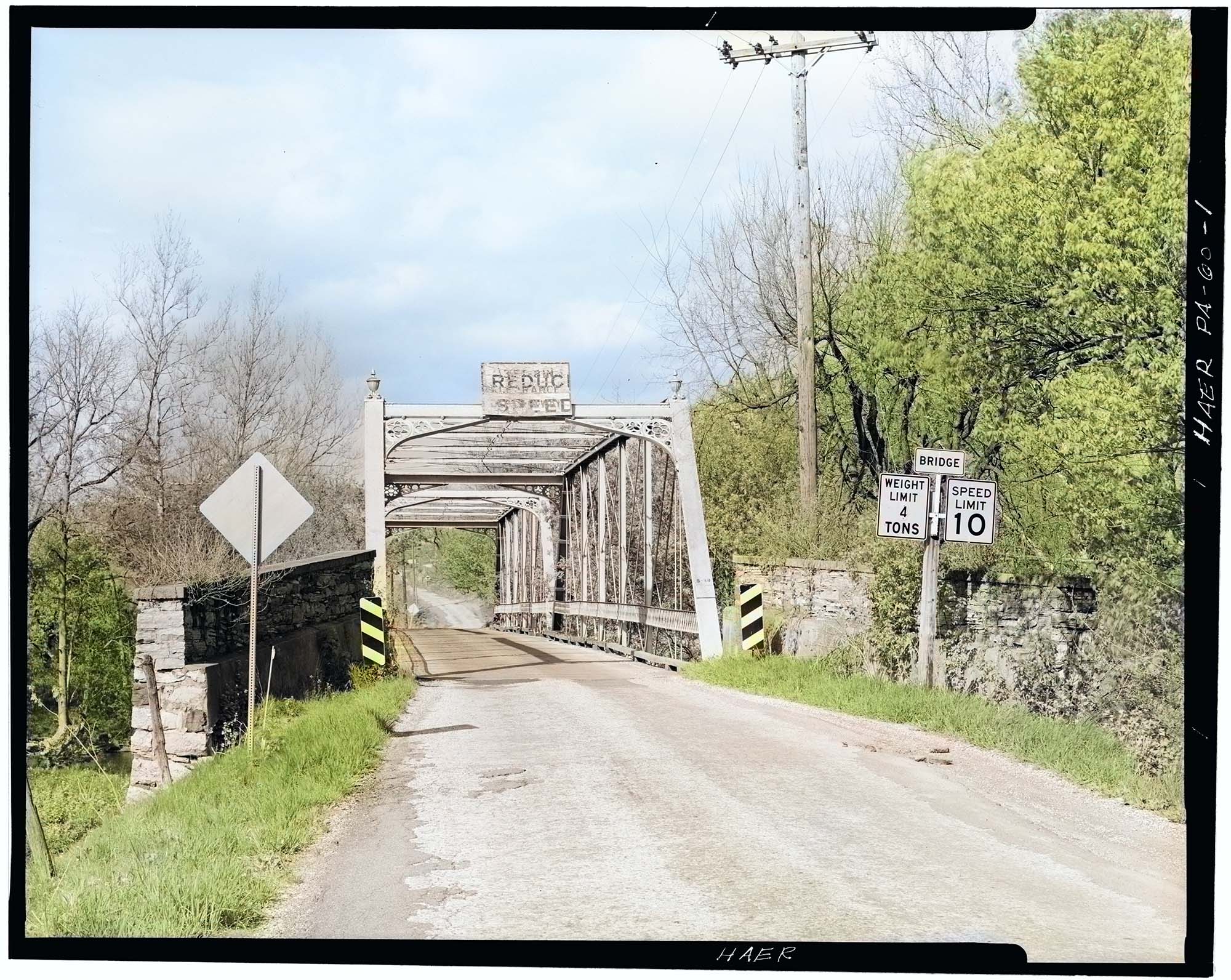
Only 8 years after the bridge’s completion the August 6th, 1886 Reading Times reported that the County Commissioners were considering lowering the bridge three feet due to the steep incline of the approaches. The topic again came into consideration nearly half a century later in the June 27th, 1933 Reading Times when repairs were being made to the bridge. It doesn’t appear the lowering was ever completed, and it wouldn’t be surprising if at least parts of those stone footings are still under the lake.
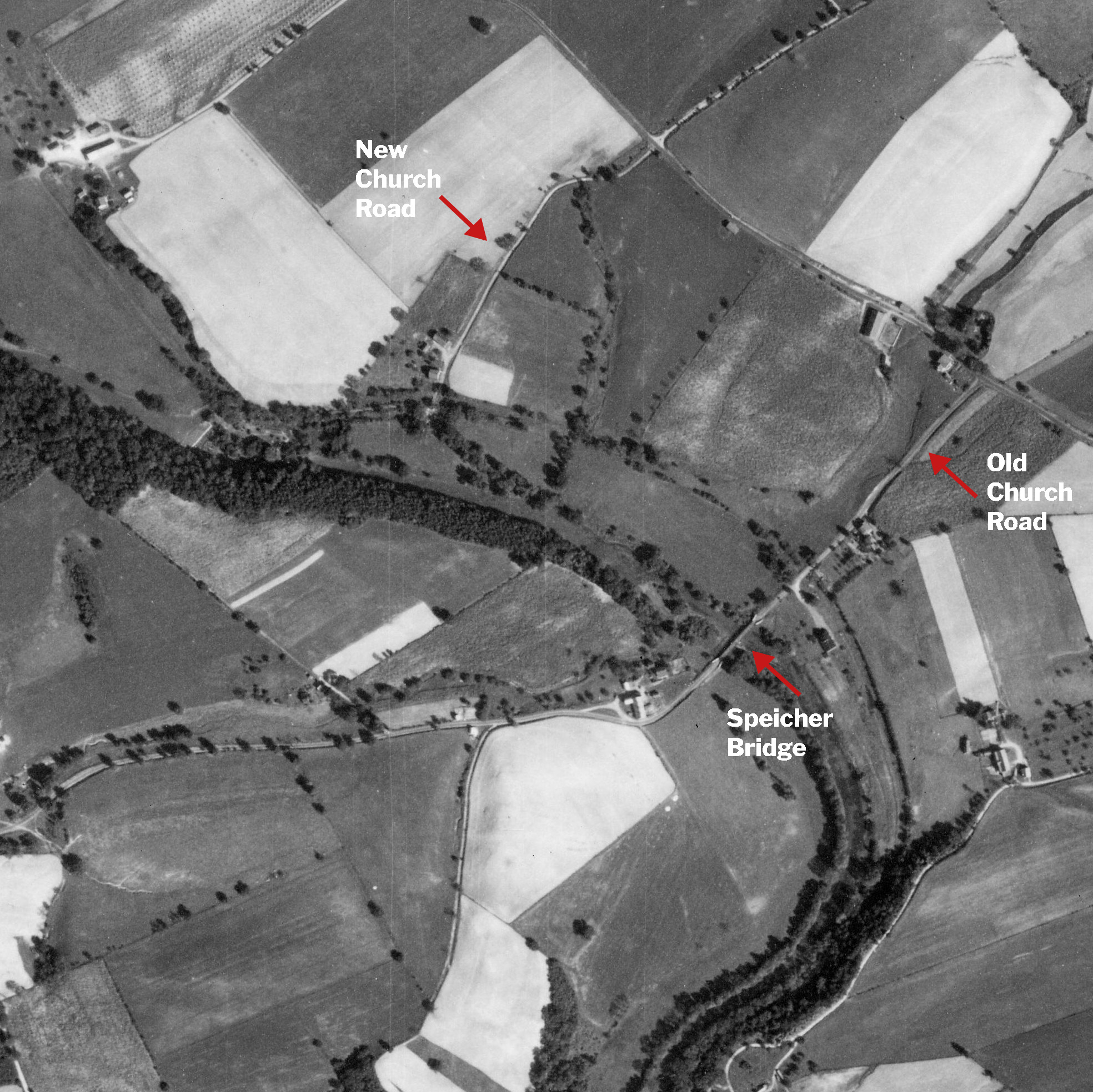
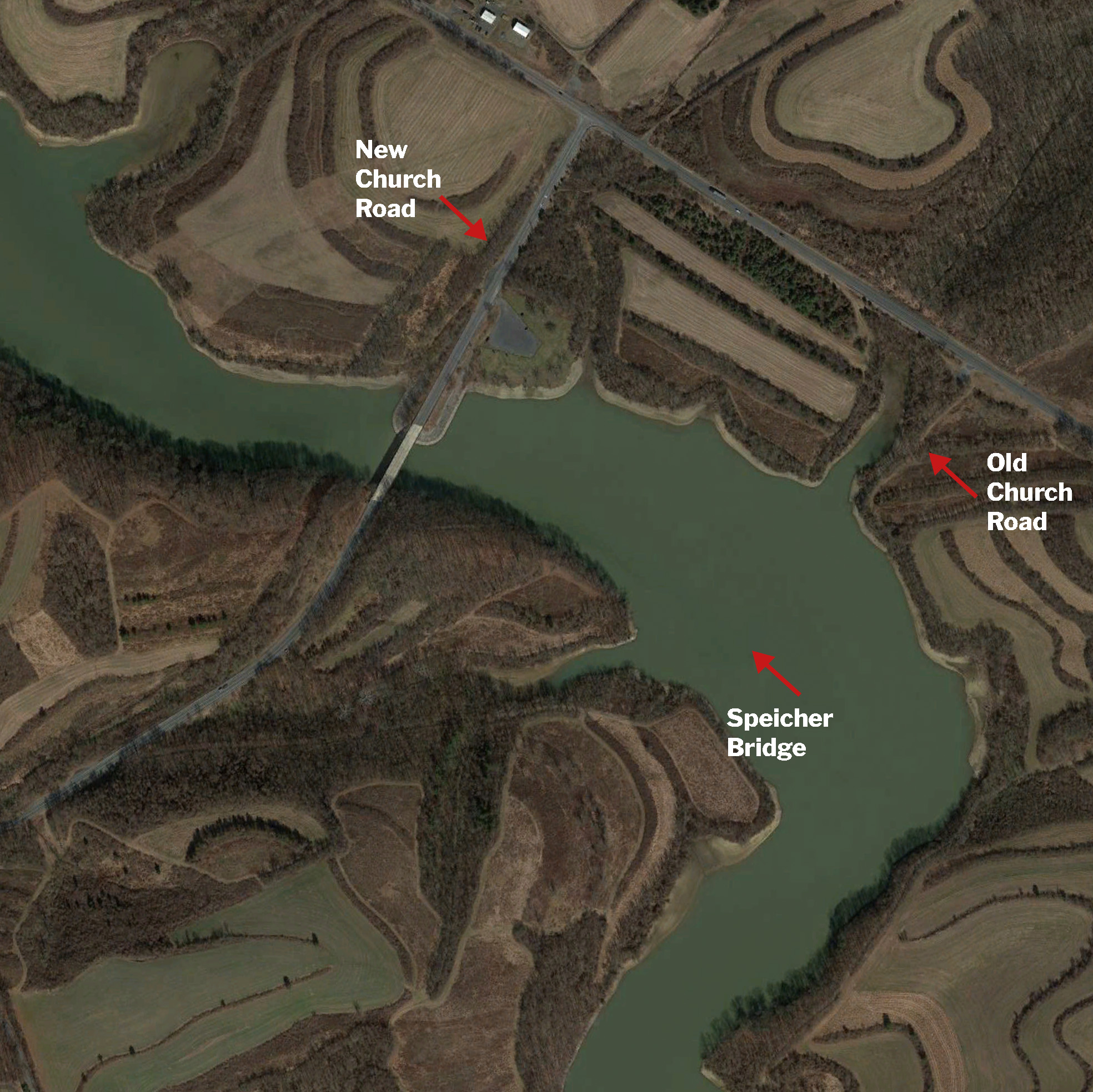
Church Road Rerouted
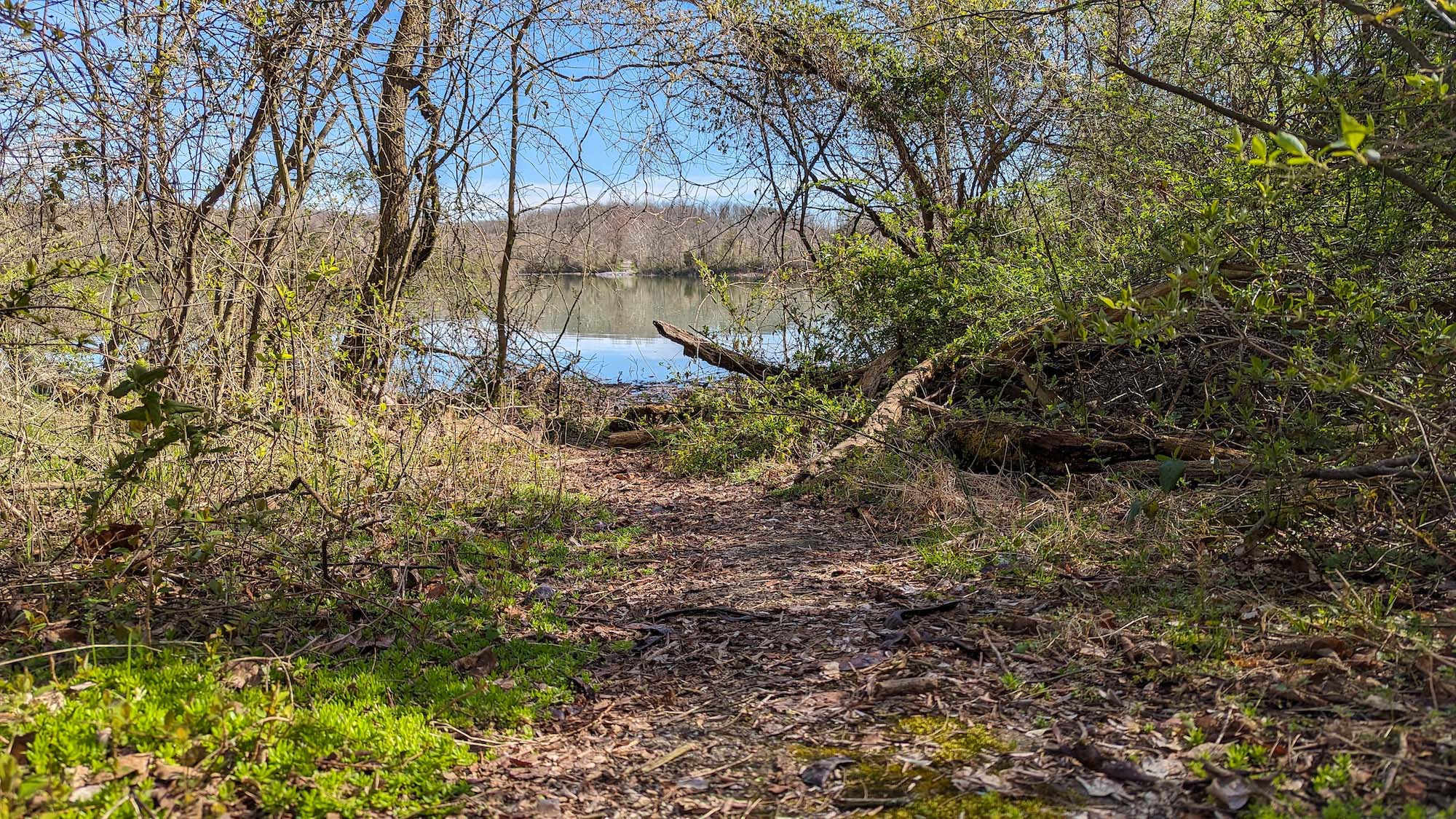
Church Road was completely rerouted roughly 1,500 feet northwest for the Blue Marsh Lake project in the 1970s. The entrance of the old Church road from Bernville Road and the farm house that once sat on the corner are now a parking area for hiking trail access. You can actually walk what was Church Road to where it ends at the lake’s edge from both directions.
Ironically they renamed Church Road, “Old Church Road” after completing this reroute. However, I have labeled them in the aerial comparison slider below with their more accurate descriptions.
I really like these movable side by side aerial images. Thanks!
I remember traveling this bridge so many times when my family lived just a mile or so up the road past North Heidelberg Church in the late 60’s, early 70’s before Blue Marsh Lake took it over. I still remember the sound of the wooden boards as we drove over the bridge and that curve in the road around the barn. I’ve also enjoyed your other articles about Fox Lake, etc. as I used to drive through there too as a shortcut over to State Hill Rd. I was in my mid teens to early 20’s. Thank you for the wonderful opportunity to reminisce! So many memories of that entire area. Your pictures are fantastic and I just pore over them remembering it all.
The Deppen Cemetery was near the bridge and moved to the county park. Also the Tivoli Club was next to the bridge.
Fantastic job! The slide feature is my favorite.